|
| SEARCH | * PROJECT O BOBS | ||||
|
Informal educators and students at Project Oceanology are currently participating in a COSEE-TEK run citizen science project to monitor water-born pesticides and marine invertebrate communities in and around the mouth of the Thames River. The regional effort includes three BOBs located at Eastern Point, Avery Point, and Pine Island located in the vicinity of University of Connecticut - Avery Point. They have been collecting data from this buoy since July 2011 and posting their findings here on the COSEE-TEK website. Click the waypoint to access the most recent images and data. 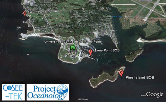 Click here to view:
Avery Point BOB
 Latitude: 41°18'58.73"N Eastern Point BOB
 Latitude: 41°19'28.63"N Pine Island BOB
 Latitude: 41°18'47.32"N Note: The Pine Island BOB was taken offline after Tropical Storm Irene in October 2011.
|
|
|||||||||